
Pigeon Valley &
Love Valley Loop
Two popular trails combined into one loop that starts from the town limits of Göreme itself.
Pigeon Valley and Love Valley are two popular trails from Göreme. You can combine the two trails to create a loop from Göreme by taking the Pigeon Valley trail to Uçhisar and then joining the Love Valley trail from Uçhisar back towards Göreme. Both trails are relatively flat and easy to navigate, Love Valley has some steep sections entering or exiting the valley and there are some sections of the trail where it’s not clear what path to take as it interweaves with the stream.
I cut out some sections of the Love Valley trail when I did this loop as I had limited supplies (food and water) with me. So rather than joining the Love Valley trailhead just outside Uçhisar, I walked along the main road till I was nearly back in Göreme and detoured into the valley and then exited the way I came.
The map below details the trail loop, but I’ve also marked on the map where I accessed Love Valley to form an out-and-back hike.
Hiking in March was still really hot, so I would recommend avoiding hiking in the direct sunlight during the warmest hours of the day. My suggestion would be to stop in Uçhisar for lunch, let some of the hottest hours get past you, and then carry on.
Also see hiking guides for Meskendir-Red-Rose-Sword Valley and Zemi Valley, or more information about Göreme, Cappadocia.
Pigeon Valley to Love Valley Loop: Trail Summary
Type: Loop
Length: 11km
Difficulty: Easy - Moderate (long sections without shade, limited supply of water enroute)
Time: 4.5 - 6.5h
Start: Pigeon Valley Trailhead East, Goreme (38°38'22.9"N 34°49'20.8"E)
End: Goreme town centre

Pigeon Valley trailhead in Goreme

Entrance into Pigeon Valley

Within the first few meters of the Pigeon Valley trail, you will pass through this tunnel.

Take this path to the right to climb up above the valley floor.

The path above the valley floor looks like this and will give you good views of the valley from higher up.

Views over the valley.

The trail starts to curve to the right as you gently incline.

As you start to reach the exit, the valley starts to level out.

As you exit the trail you can see Uçhisar ahead of you.

I chose to walk along the road back towards Göreme to reach Love Valley.

Rather than follow the bend in the road towards Göreme I kept left onto this dirt track towards Love Valley.

Follow the dirt track till you reach Love Garden Cafe and walk through it.

Past Love Garden Cafe are some carved-out steps that lead into the valley.

At the bottom of the steps, turn right into Love Valley.

If you turn left after the steps you will walk through the valley here.
Pigeon Valley
Type: One-way or out-and-back, from Göreme to just outside Uçhisar.
Length: 3km one way
Difficulty: Easy
Time: 1 - 1.5h
Start: Pigeon Valley Trailhead East, Goreme (38°38'22.9"N 34°49'20.8"E)
End: Adnan Menderes Cd., Uchisar (38°37'56.3"N 34°48'32.5"E)
You can reach Pigeon Valley from the very edge of Göreme town. I was surprised that there weren’t any signs directing you to the trailhead in the town itself, so don’t rely on these if trying to locate the trailhead.
The trailhead itself is marked with a large sign and map. Once on the trail, it’s pretty easy and flat. There are a couple of offshoots from the main trail but they all lead back to the same place. Some will take you up above the valley floor and some will stick to the valley floor. I recommend taking the path up because you get some really great views over the whole valley. There are some fun caves and quiet viewpoints that you can stop at and explore, which are great if you want to escape some sun.
As you come nearer the end of the trail there are a couple of options of where to exit. They largely all join the same main road that runs alongside Uçhisar but at various points. The closest exit, which is the one detailed above and the one I took, takes you to just outside Uçhisar and is the best option if you are looking to immediately loop towards Love Valley or catch a lift from the main road. Exits further along will be better if you want to head into Uçhisar town itself.
This was a short, easy and relatively simple trail and I think a great beginner trail to experience navigation and solitude whilst still being close to two main towns. I hiked this trail in the morning and it wasn’t busy. I passed maybe 3 other walking ‘groups’ and had a stray dog follow me for part of the way.


To join the Love Valley trail you will walk along the main road away from Uçhisar for a short while until you come to a Y-junction where two roads merge into one main road towards Göreme. Here you want to take a left towards the gift stores and continue along this road. Take a right just before Karma Camping and follow this path until you get to the trailhead for Love Valley. This trailhead is marked on Google Maps (Baglidere Vadisi - Ask Vadisi - Love Valley).
Love Valley
Type: One-way or out-and-back.
Length: 4km one way
Difficulty: Easy - Moderate (steep sections when entering/exiting the valley, and some unclear sections)
Time: 2-3h
Start: ‘Love Valley’, Baglidere Yolu, Uchisar (38°38'31.3"N 34°48'47.4"E)
End: ‘Love Valley Trail’ (38°39'49.3"N 34°49'45.6"E)
By the time I reached Love Valley, I was hot and I was tired so I wasn’t planning to walk the whole trail from top to bottom. Instead, I ‘popped’ into the Love Valley, taking the steps down into the valley from Love Garden Cafe (marked on Google Maps). There was also a water tap here which I was able to fill my water bottle up with.
You cannot fully appreciate the phallic-shaped rock formations from above, you really need to be on the valley floor to experience this. The rocks are magnificent, but during the midday sun they don’t cast much shade, so it’s not very comfortable being in the area for too long. As you walk along the trail, either towards the start or end points, the landscape changes to fewer towering rocks and more smooth formations. There is also more greenery and if you’re lucky some tortoises about. This is all to say that if you are looking for the infamous rock formations of Love Valley you will need to be in the heart of the valley to see them.
After about an hour of walking around, I went back the way I came, up the steps to the cafe, and then returned to the dirt track to head back into Göreme. From exiting Love Valley, I took the dirt track on the right that loops towards the main road. This track gives you amazing views over Rose Valley and proved to be a good spot for sunset and an even more amazing spot for the hot air balloon sunrise. More on that on the Göreme page.


If you follow the full trail through Love Valley, you will exit the trail to the north of Göreme at a road. I couldn’t find the name of this road, but from here you want to head right along the road and then right again to join a dirt track that runs parallel to the valley and heads south towards Göreme. This track is very exposed, with not much shade and not much view. Alternatively, rather than turning onto the dirt track you could continue along the road until you reach the main road that connects Göreme to Çavusin. If you’re lucky you may be able to hail down a dolmus making trips between the two towns (most likely to occur during peak tourism season), or hail a taxi or hitchhike.
A quick note about hiking:
Göreme is made up of many valleys. You will be hiking through them or along the ridges, either way, you will be very exposed for the majority of the trails. It is therefore important that you are well prepared for the weather.
There are also minimal facilities available, particularly if you travel outside of peak tourist season. Access to water, food, facilities or support is heavily reliant on locals opening up their homes or setting up stalls. It is therefore not a guarantee that a cafe marked on the map will be stocked or open.
Finally, routes are not always well marked and paths are not always clear (I would avoid relying on spray-painted arrows as they are often contradictory). As you are walking through valley floors, paths that are there in the Summer may become rivers in the Spring. Make sure you have a form of navigation available and back-up navigation if relying on your phone.
See my blog post about how I prepare for solo hikes for more general information about solo hiking.
Cappadocia hiking packing list:
Water (plenty!) I use a water bottle with a LifeStraw so that I can filter water should I come across a stream or water tap. However, Göreme is pretty dry, so I wouldn’t rely on natural water sources.
Sun protection - definitely a sun hat. Suncream. Lip balm. Sunglasses. Shawl/cover for shoulders.
Navigation - I recommend Maps.Me which is a free offline navigation map that shows trail paths (unlike Google Maps). There are other paid options which may be better like AllTrails.
Snacks - there are nearly no food options available, even when cafes and stalls are open they mostly sell drinks.
Portable charger
Basic first aid
Torch - if hiking early morning or in the evening
Cash - in case you need to take public transport or taxi. They will not accept card.
Need to knows
There are very few, if any, water points along the trail. Pigeon Valley itself did not look like it had any drink stalls located in it, and therefore if you need food or water you will need to head into the nearby towns.
R’s take
Pigeon Valley in particular is a great beginner trial. It’s close to town, relatively short, mostly flat, and fairly easy to navigate. This is a very achievable trail if you want to try a solo hike.

Signage to Pigeon Valley, which is actually along a dirt path to the left, and not the paved path on the right.
Pigeon Valley trailhead East
Pigeon Valley trail
Tunnel at the start of Pigeon Valley trail

Caves within Pigeon Valley

Pigeon Valley
The trail branches to the right and inclines to come above the valley floor.
Pigeon Valley, from the trail that comes above the valley floor

The trail I took to come above the valley floor.
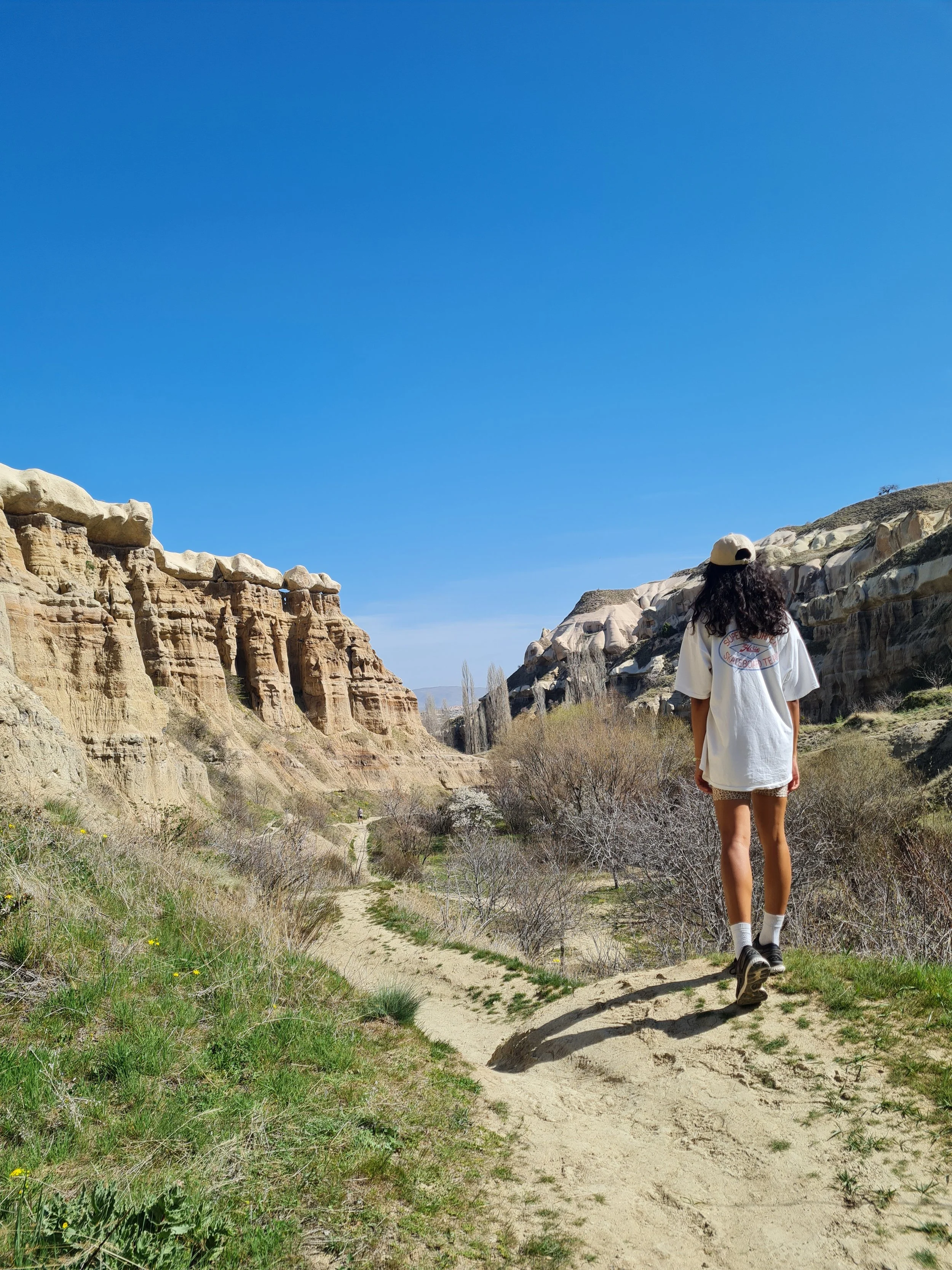
Pigeon Valley

Pigeon Valley

Pigeon Valley
Pigeon Valley

Pigeon Valley
Trail towards the end of Pigeon Valley

Pigeon Valley

Towards the end of Pigeon Valley trail, you can spot Uçhisar.
The end of Pigeon Valley trail outside Uçhisar

Main road leading to Uçhisar from Göreme


View from Salkim Tepesi Panorama Restaurant
The main road between Göreme and Uçhisar

View over Pigeon Valley and Göreme
Dirt track leading towards Love Valley
Love Garden Cafe

View from Love Garden Cafe

Love Valley
Steps into Love Valley from Love Garden Cafe

Love Valley

Love Valley

Love Valley

Love Valley

Love Valley

Love Valley
Landscape of the Love Valley trail between Uçhisar and Love Valley

Love Valley
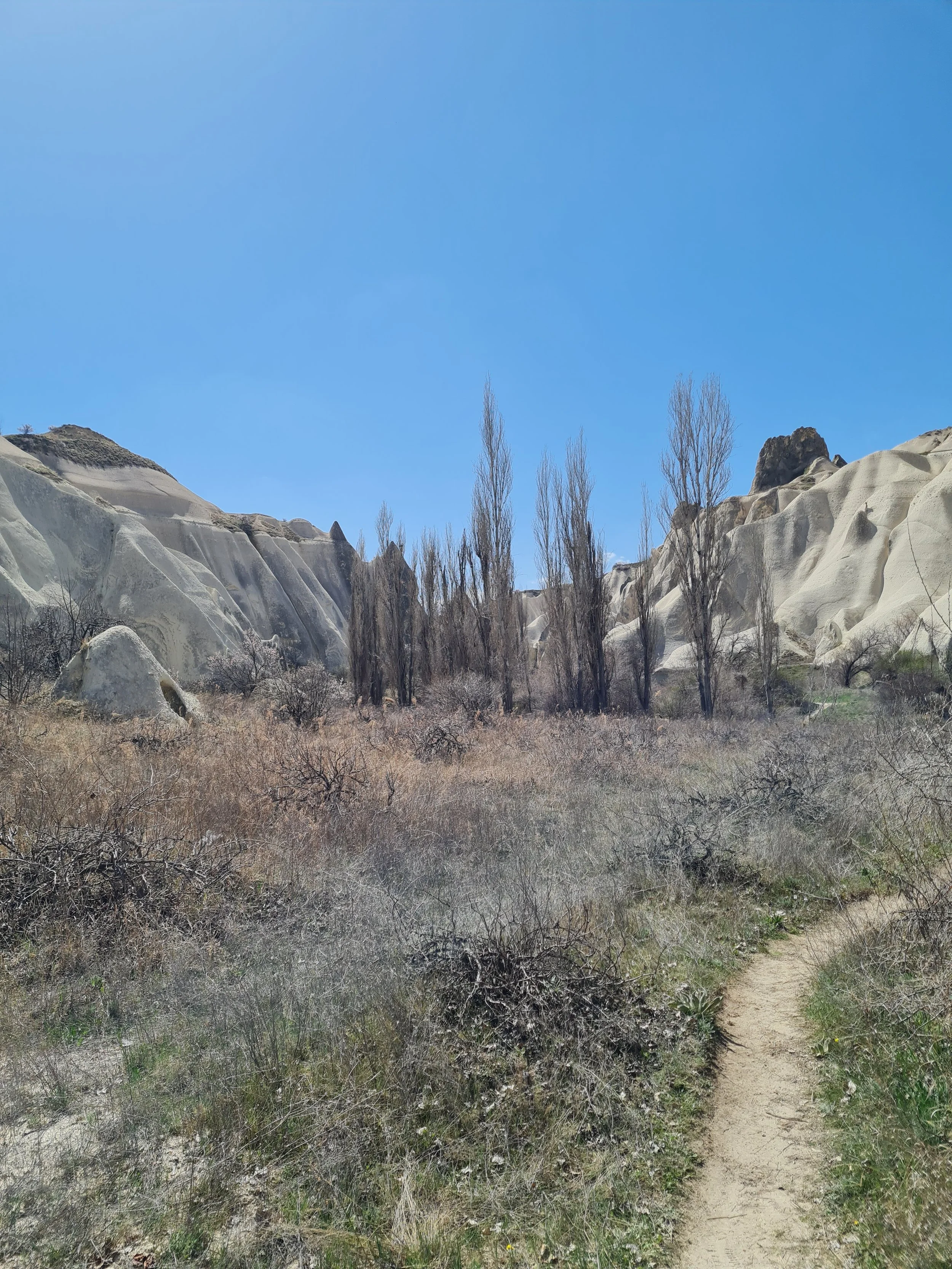
Landscape of the Love Valley trail between Uçhisar and Love Valley
