

Meskendir, Red, Rose
& Sword Valley Loop
Four great valleys rolled into one large loop. Hike for the amazing landscapes and remarkable hidden cave churches.
This trail looks big on paper, but it actually didn’t take all too long. If you’re being quick, this could be done in half a day. But given the heat I took it easy and spent around 1.5 hours during the hottest part of the day sat in the shade at a cafe for lunch break.
I loved hiking this loop. The landscapes were incredible and after navigating 4 valleys solo I had such a sense of achievement! I highly recommend a trip to Rose Valley at the very least - it has some amazing cave churches to explore.
To get to the start of the trail, Meskendir Valley, requires walking out of Goreme for 2km and takes about 40 minutes. From here on, each valley is connected to the other and is generally easy to navigate as you’ll be able to see it. The only bit you need to look out for is the path between Meskendir Valley and Red Valley.
This trail is a little more technical in some sections and will require some climbing up ladders, and scrambling up valley faces. I think there are alternative routes if you want to avoid sections like this but you will need to do your research. As you enter and exit each valley you will have to walk steep sections. Meskendir Valley is quite leafy and green and so provides some shade, but after that, you’re quite exposed to the sun in the other valleys.
Below is a map of the looped trail, and then details about each valley hike as a stand-alone and how it can be combined into the loop. Giving credit where credit is due, I used this blog post by Sailingstone Travel to help me navigate the route.
Also see hiking guides for Pigeon Valley & Love Valley Loop and Zemi Valley, or more information about Göreme, Cappadocia.
Meskendir, Red, Rose, and Sword Valley Loop: Trail Summary
Type: Loop
Length: 11km
Difficulty: Moderate (steep sections in and out of valleys, some sections require climbing ladders, walking through dark tunnels, and scrambling)
Time: 5 - 7h
Start/End: Goreme

Take the main road out of Goreme towards the Goreme Open Air Museum

No cars are allowed around the Open Air Museum, but you can still walk by foot. Continue past the barrier.

Due to ongoing excavation, you will have to come off the road and take the detour steps on the right.

Once you rejoin the cobbled path, continue past the museum. The road becomes steep with sharp bends.

At the top of the hill is another barrier for cars coming from the opposite direction. Continue past this barrier and along the road.

Along the road, you will pass this cave on your right which you can explore.
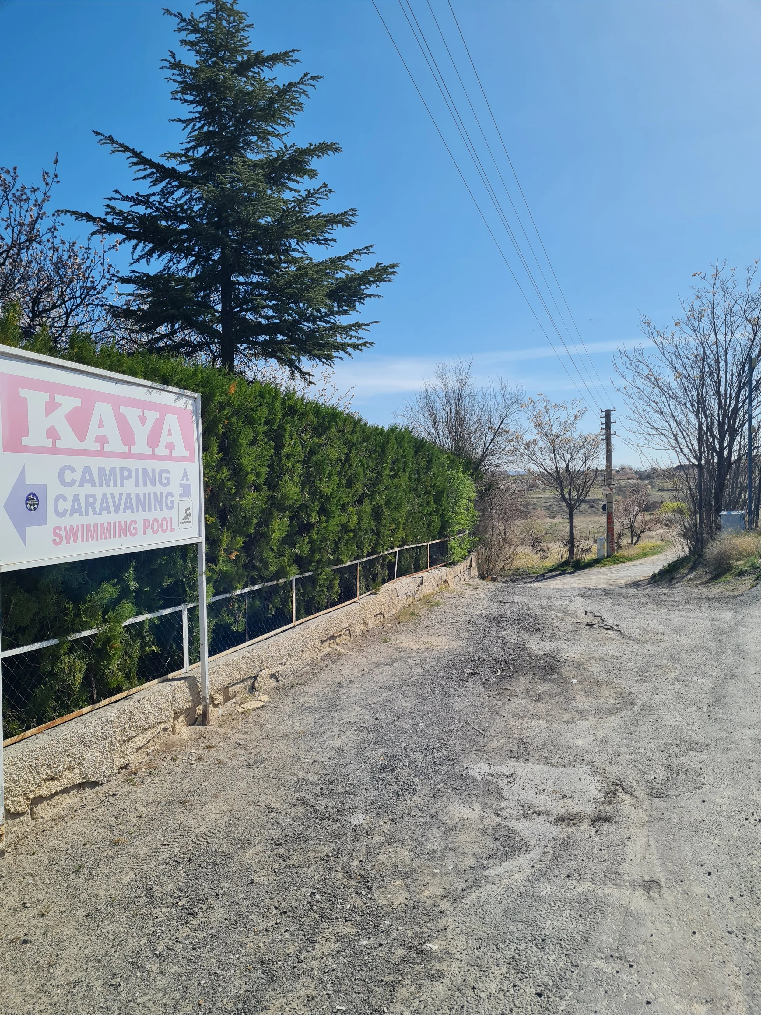
On the left, you will pass Kaya Camping. Take the dirt road immediately after this on the left, as pictured.

The dirt road splits 3 ways. You want to take the right-most path pictured here.

The path leads to a steep decline into Meskendir Valley. I had to bottom shuffle down here because it was so steep.

MESKENDIR VALLEY is quite easy to navigate with clear paths. It is mostly green and flat.

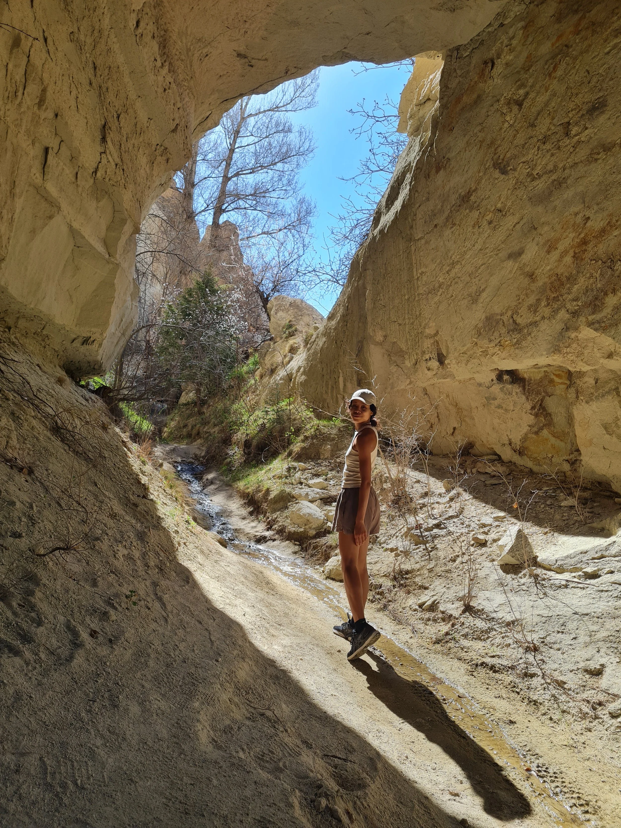
There are many tunnels you pass through.

The valley floor can get wet and muddy, especially during Spring.

A right turn off the main trail at this stone sign will take you towards Red Valley. It is not indicated on the sign so you will need to use a map.

The trail towards Red Valley is very much the same as Meskendir Valley.

From here on there are regular signs directing you to Red Valley

You will pass Red Valley Tea Garden which sells juice, fruit & nuts and has a toilet.

After Red Valley Tea Garden, the path splits into two different routes which both take you Red Valley. The route to the left is via this ladder and involves walking through a dark cave tunnel. A torch is required.

The route to the right involves a steep incline up the path. I took this route.

Once you reach the top of the incline, you can see Red Valley ahead of you.

Entrance into Red Valley. If you come by car, this is an alternative route in.

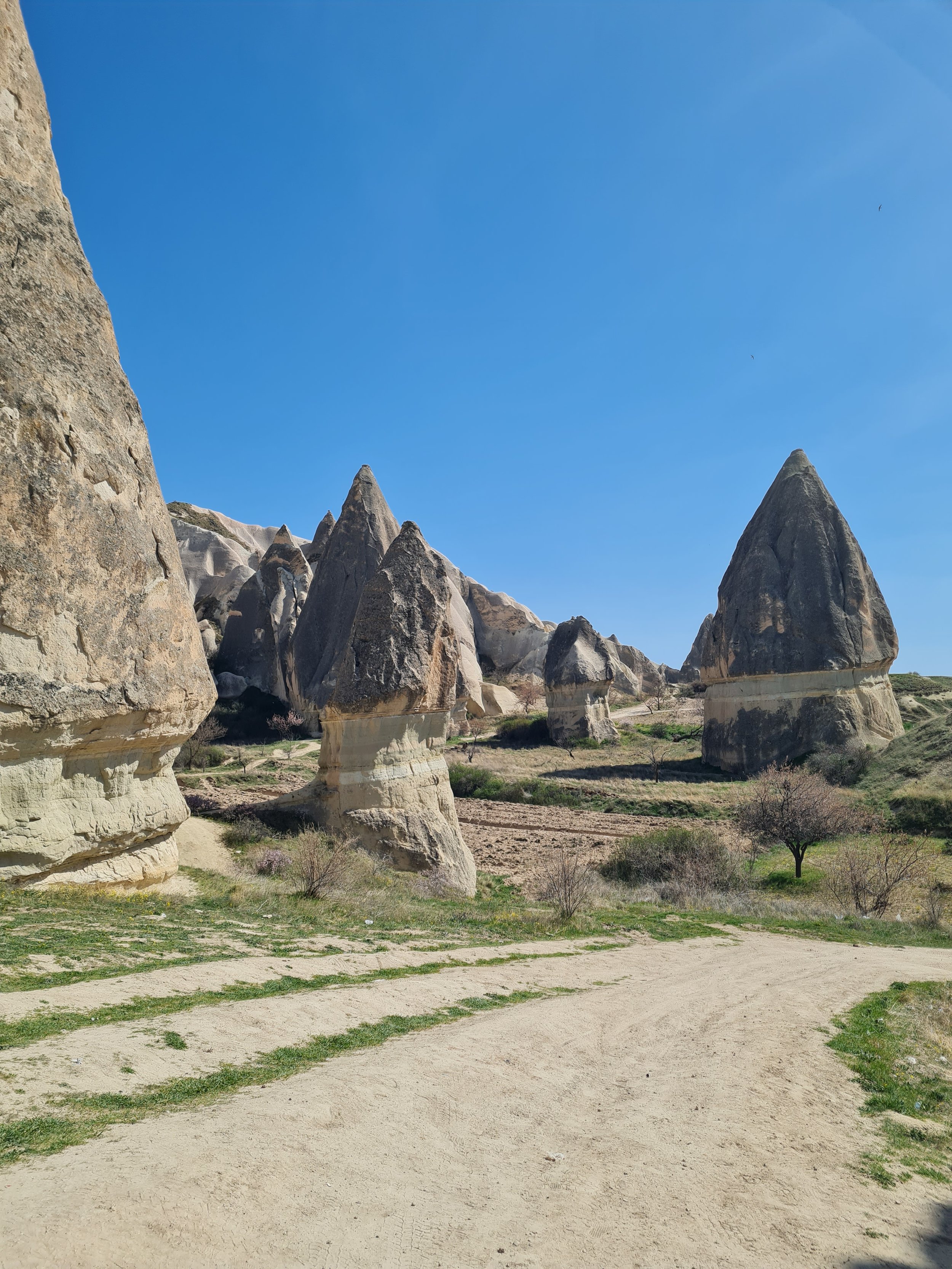
RED VALLEY. This is the whole of Red Valley. It is quite small but with cafes and many caves to explore.

If you walk directly through Red Valley you will face these steps. This is a quick way out of the valley.

After the ladder are some carved steps. You will need to use the chain to help yourself up.

Once you climb out of the valley, directly in front of you is ROSE VALLEY.

Walk left along the top ridge and on your right will be a steep path into Rose Valley.
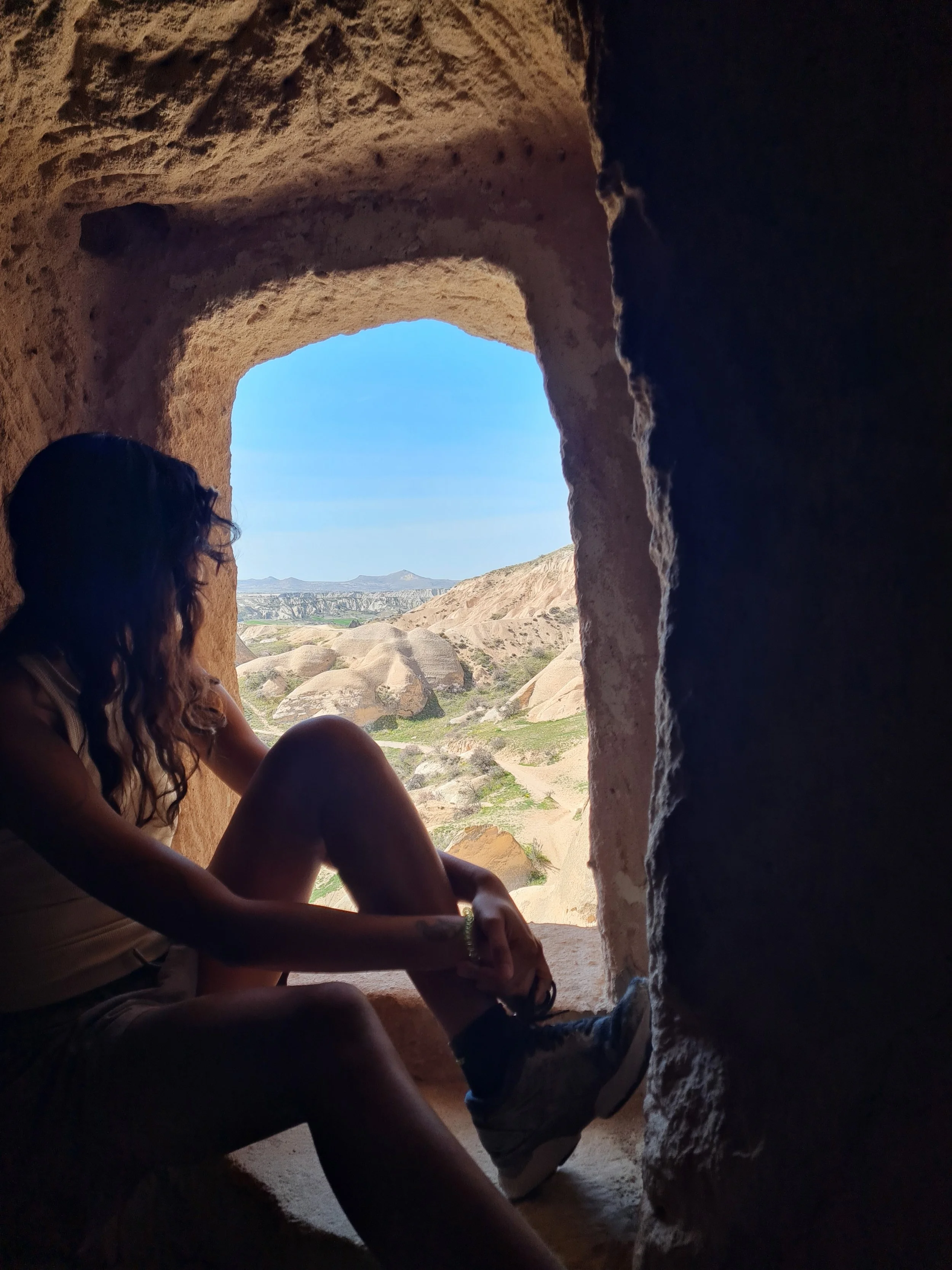
Rose Valley has a lot of short up and downs. There is very little shade, but quite a few church caves you can shelter in.

The outside of Column Church Cave - Direkli Kilise (Kolonlu)

The inside of Column Church Cave.

Rose Valley is a bit of a maze because there are lots of different paths you can take and lots of different ruins and caves to visit.
Star Box Cafe next to the Crusader Church

Star Box Cafe. I sheltered here during the hottest hours of the day.

Next to the cafe are some toilets

Entrance to the Crusader Church - Haçlı Kilise
Inside the Crusader Church - Haçlı Kilise

From the Crusader Church, the exit of Rose Valley is only a couple 100m. You then exit back onto the Meskendir Valley trail. Turn left, heading back towards Goreme.

You're on the Meskendir Valley trail for a short while before taking a right and heading uphill out of the valley, and then downhill into Sword Valley.
SWORD VALLEY. You'll be able to see Goreme in the distance towards the right. Walk straight through Sword Valley and probably past some ATVs to join the dirt road leading into Goreme.
Meskendir Valley
Type: One-way or out-and-back.
Length: 3.5km one way
Difficulty: Easy (clear path, flat, shaded)
Time: 1.5h including time to explore caves
Start: Take the dirt track path to the right of Kaya Camping (38°38'28.4"N 34°51'21.6"E)
End: (38°39'44.3"N 34°50'27.9"E)
From Göreme, walk along the main road towards Göreme Open Air Museum (Muze Cd. road). Part of the road is closed to vehicles around the museum but it’s still fine for pedestrians to walk so don’t be deterred by the barriers. Just before the museum part of the road is being excavated, so you will need to come off the road and take the steps to the right to avoid this area. Once you are past the museum, the road turns into a cobbled path that steeply ascends and bends. Once at the top of the hill you will pass another road barrier and be back on the main road. Continue along to road until you reach Kaya Camping. Just past Kaya Camping is a dirt road on the left. Follow this dirt road which immediately splinters into multiple different paths. You want to take the diagonal path - not the one directly in front, and not the one on the left against the wall. You’ll know it’s the right path because after a couple of meters, you’ll see Meskendir Valley in front of you and the path with steeply descend into the valley.
The path into the valley is steep and I had to bottom shuffle my way down due to the slippery gravel. Once on the valley floor, it’s pretty straightforward. The paths are clear, it relatively flat, and very green and shaded throughout. Some sections get muddy and wet, particularly in Spring, so watch out. Shortly after entering the valley is Mesgendir Valley Cafe. The owner is very friendly and etches out a map of the trail towards Red and Rose Valley which it seems he does a lot as the ground is well carved from this.
There are a couple of churches you can explore in the valley that involve detouring off the main path.
About 2km into the trail there will be a path on your right. There is a stone sign at this junction, although it doesn’t indicate Red Valley. I’ve taken a picture of this marker which you can see in the trail summary above. Take this turning right and continue on the path to head towards Red Valley.
Detour: You can continue along the Meskendir Valley trail and stick to the main path, (i.e. not taking the path on the right towards Red Valley). If you continue along the Meskendir Valley trail it will eventually take you towards Cavusin. From here you can either take the loop in reverse and head through Rose Valley and then Red Valley. Or you could loop through Sword Valley and back to Göreme. Or you could end your hike in Cavusin and take a taxi or dolmus back to Göreme.

The trail between Meskendir Valley trail and Red Valley is very much like Meskendir Valley itself. It’s flat and green and shaded with a couple tunnels. This path is actually well signed throughout with signs directing towards Red Valley (rather than spray-painted arrows) and easy to follow. You will pass a cafe, Red Valley Tea Garden, that sells drinks and snacks and has a toilet. Just after this cafe, the path splits into two different routes, both which take you to Red Valley. One of the paths involves climbing a tall ladder into a cave tunnel, which will require a torch. This path takes you to one side of Red Valley. The alternative path, which is on the right, is a steep dirt path up and out of the valley floor. This is the path that I took, and once at the top, you have great views over Meskendir Valley and across to Red Valley. This path takes you to a different end of Red Valley compared to the route with the ladder.
Red Valley
This is more of a destination rather than a trail as Red Valley is so small you can see one end from the other and it’ll take you a couple of minutes to walk across it. It does however have plenty of caves to explore, a cafe in the valley, and more stalls and restaurants on the valley ridge. So you can spend a decent amount of time here should you choose.
Many people choose to drive to Red Valley. You can park at the end of the main road on the ridge of the valley where all the cafes are located, or take a left down a dirt road before the end of the road for a quieter spot which is good for camping.
Things to see & do in Red Valley:
Watch the sunset. From Red Valley you can face west and watch the sun set below the horizon. The golden glow lights up the whole valley showcasing its red hue. This is one of the best sunset spots in Cappadocia.
Panoramic Point. Up on the valley ridge, you have great views across Red Valley extending towards Goreme. Walk along the ridge some more to get views of into Rose Valley too.
Grab a drink or a bite to eat with stunning views over the surrounding valleys. There are a couple of cafes set up here, but will most likely only be open during the busier Summer months.
Üzümlü Church (Grape Church), named so after the vineyards that surround it, is an old church ruin that has been recently restored. It’s tiny, basically one room, and is almost always locked to the public. However, there is a large gap under the gate if you are eager to look inside. The ceiling artwork has been recently restored and looks beautiful.
Climb into and explore all the different cave homes. There are quite a few dotted around Red Valley and offer a nice shaded spot to relax and enjoy your surroundings.
To exit Red Valley you just need to climb back up to the ridge. There are a couple of paths that take you straight up to the main road. Or, there is a ladder just to the left of Üzümlü church which you can climb for a more direct route out of the valley in the direction of Rose Valley. You will need free hands to climb this section as after the ladder are some carved-out stone steps with a handrail to help pull you along.
Just on the other side of Red Valley, over the ridge in the northwest direction, is Rose Valley. Whatever way you choose to get up onto this ridge, follow the path along the top towards or alongside Rose Valley. On your right, there will be a steep dirt path that snakes down into Rose Valley. It’s not immediately clear, or well-signposted, but there are not many other options available into the valley so you’ll know this is the right one.
Rose Valley
Type: One-way or out-and-back. You can also make it a loop by taking alternative paths through Rose Valley.
Length: 2.5km one way
Difficulty: Moderate (lots of short sections of incline and decline. Very little shade and no sources for water)
Time: 2h (with time to explore cave churches and rest between shaded spots)
Start: From Red Valley (38°39'12.6"N 34°51'31.3"E)
End: “Rose Valley 1 Trailhead” on Google Maps (38°39'32.9"N 34°50'35.1"E)
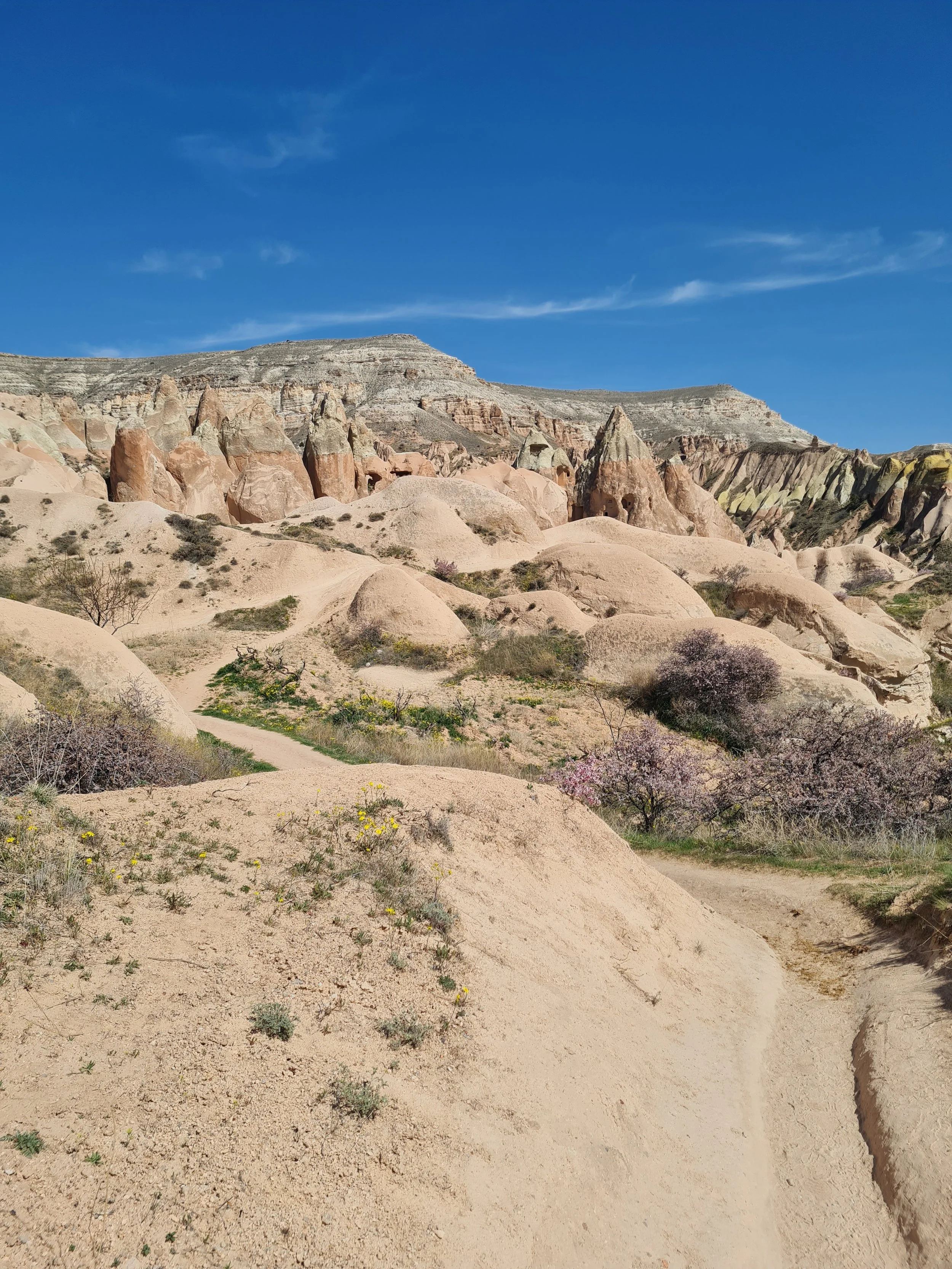
The path into Rose Valley is steep and gravelly. Once in the valley, there are many paths that lead in all different directions, and indeed there is a lot to explore in Rose Valley should you choose. This is why it’s best to have a map with you so you can best distinguish the paths you want to take to see the sites you are interested in or to navigate the easiest route out. There were a lot of steep sections in Rose Valley, although short. However, the lack of shade and the steep valley walls mean it’s very hot in here, and so any incline feels much harder under the heat. Take it slow, and any time you happen upon shade or a cave take time to rest because they are few between.
I won’t give directions for this valley as it really depends on what you want to see and how long you want to make the trail. Instead, I list some of the sites you may want to visit.
Things to see & do in Rose Valley:
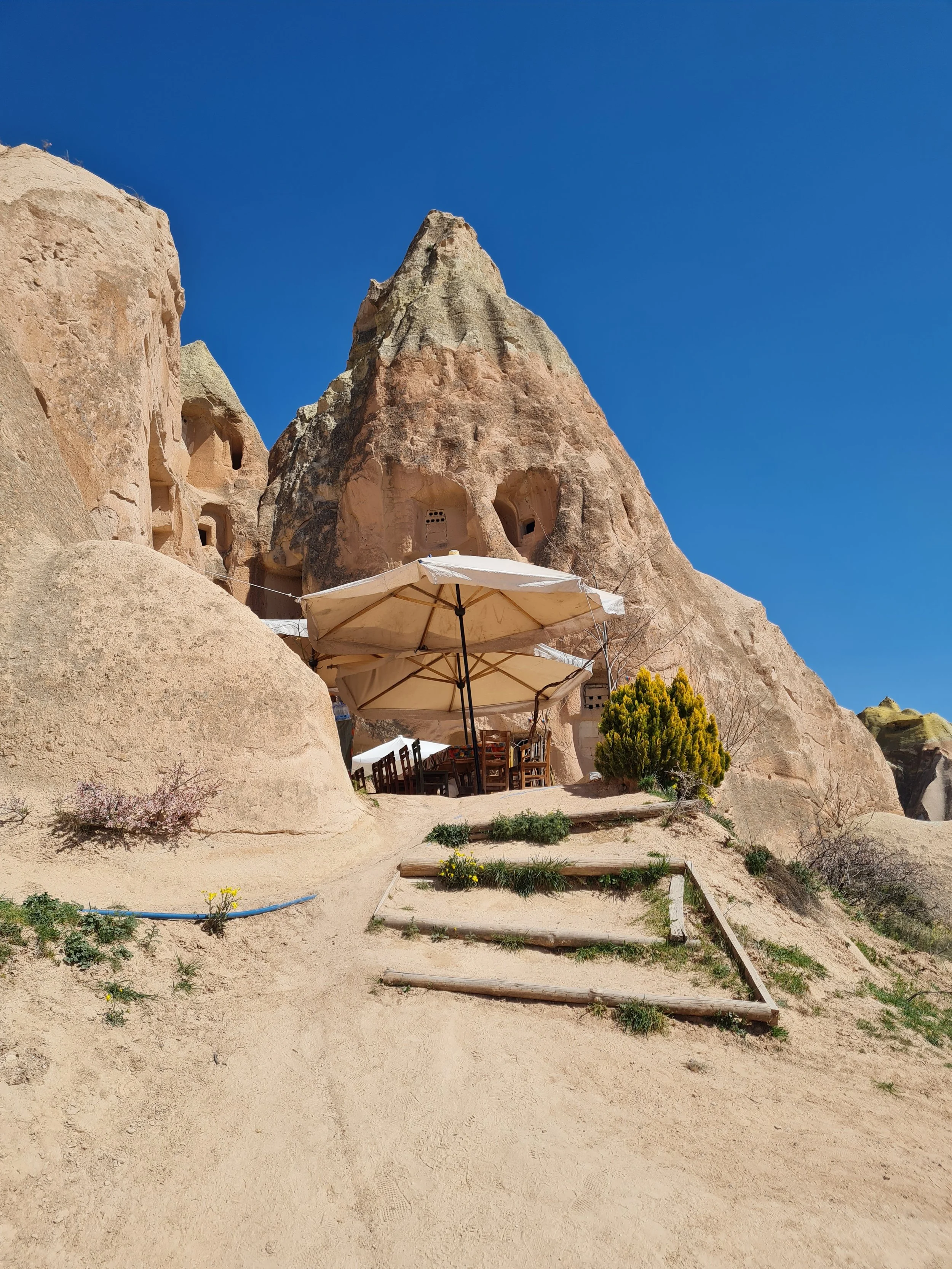
Direkli Kilise / Kolonlu (Column Church). This was so impressive! The outside gives no indication to the size of the interior of this church. The church has a sign outside it, although not very obvious, but you’ll notice the wooden ‘draw bridge’ to get inside. Once inside, the church has two floors to explore and 4 main rooms. It’s the second floor that’s most impressive. When you walk up the steps the cave will open out into this huge space with large columns carved in, hence its name.
Anna Johachim Kilisesi. Most recent reviews say that you can’t access the church as it’s locked. I didn’t go in myself.
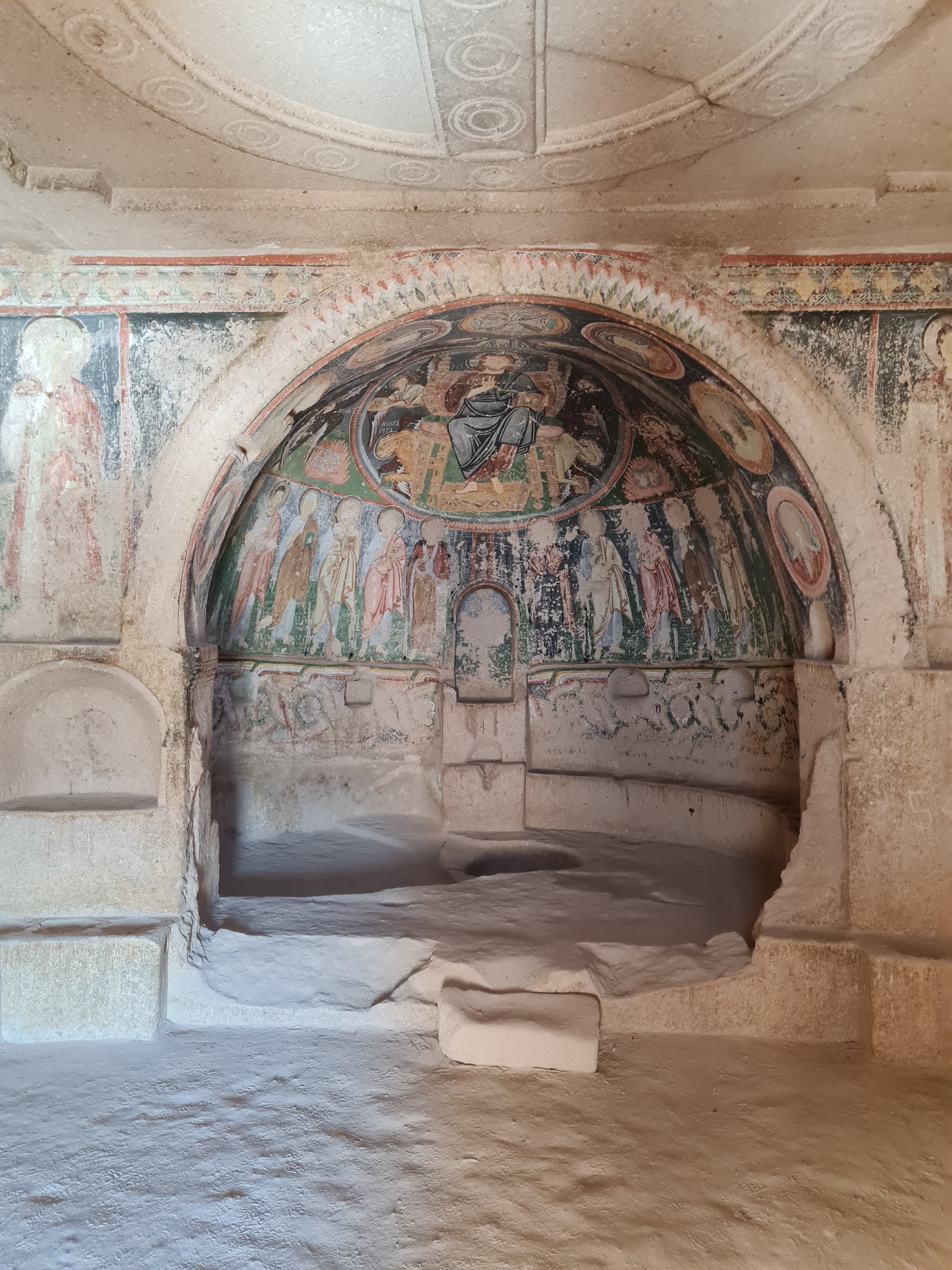
Haçli Church (Crusador Church). A couple of sketchy wooden steps take you to the entrance of this cave church. Inside is a large and well-preserved fresco. The positioning of the windows and the afternoon sun mean that this cave is actually quite well-lit should you want to stay here to rest in the cool shade.
Located next to Haçli Church is a small cafe, Star Box Cafe, selling fresh fruit juice. This was a good stop to rest and get out of the sun for a bit. There are porta-toilets nearby and from the looks of it a stop for horse/camel rides.
3 Haçli Kilise. This is located on the outer trail of Rose Valley so I didn’t quite make it to this church. However, online images show an impressive multi-room church with frescos and carvings throughout.

Inside Direkli (Kolonlu) Church - (Column Church)
Inside Haçli Church (Crusador Chruch)You’ll gently start to ascend as you exit Rose Valley with views of Goreme in front of you. Below you is some empty valley space that is used by ATVs, dirt bikes and jeeps to play around in and further on is the continuation of the Meskendir Valley trail. As you descend, rejoin the Meskendir Valley trail headed left/south. (If you turn right/north you will walk towards Çavusin.) Walk along the Meskendir trail for a short distance until you see a path to your right that starts to climb out of the valley. You can tell this is the right path as immediately opposite this path is a drinks stall and some toilets (this is marked on Google Maps as “Wc”). Walk up this steep path exiting the valley, and almost as soon as you reach the top you start to descend into Sword Valley.

Eglise - church in Sword ValleySword Valley
Type: One-way or out-and-back.
Length: 1.5km one way
Difficulty: Easy (flat and clear paths)
Time: 1 hour one way
Start: Taking a path off the Meskendir Valley trail opposite a drinks stall and toilet (marked Wc on Google Maps) (38°39'20.5"N 34°50'45.8"E)
End: Dirt track road that leads back into Goreme in under 1km (38°38'59.2"N 34°50'20.4"E)
Once you have exited from the Meskendir Valley trail, and are descending into Sword Valley you will notice more homes and small farms, signalling a closer proximity to Göreme town. The path diverges and snakes around private properties but keep heading in the general southwest direction towards Göreme which you should be able to see ahead of you.
The rock formations in Sword Valley are short and squat fairy chimneys. There is a large church cave here called “Eglise-church”. Around Sword Valley is more open landscape used for ATVs so expect to see a couple of them driving around.
After a short dabble in Sword Valley, I was ready to rest my feet and head home, so I took the most direct route to reach the main dirt road west of Sword Valley, crossed this to join “Mezarlik Sk.” road and followed this back into Goreme.
Detour: If you want to make the route a little longer, you can continue walking through Sword Valley headed south or southeast. This will eventually either take you all the way back to the Kaya Camping junction, or somewhere along Muze Cd. road.
No matter which route you take, you will eventually end up on a main road that leads you back into Goreme.
A quick note about hiking:
Göreme is made up of many valleys. You will be hiking through them or along the ridges, either way, you will be very exposed for the majority of the trails. It is therefore important that you are well prepared for the weather.
There are also minimal facilities available, particularly if you travel outside of peak tourist season. Access to water, food, facilities or support is heavily reliant on locals opening up their homes or setting up stalls. It is therefore not a guarantee that a cafe marked on the map will be stocked or open.
Finally, routes are not always well marked and paths are not always clear (I would avoid relying on spray-painted arrows as they are often contradictory). As you are walking through valley floors, paths that are there in the Summer may become rivers in the Spring. Make sure you have a form of navigation available and back-up navigation if relying on your phone.
See my blog post about how I prepare for solo hikes for more general information about solo hiking.
Cappadocia hiking packing list:
Water (plenty!) I use a water bottle with a LifeStraw so that I can filter water should I come across a stream or water tap. However, Göreme is pretty dry, so I wouldn’t rely on natural water sources.
Sun protection - definitely a sun hat. Suncream. Lip balm. Sunglasses. Shawl/cover for shoulders.
Navigation - I recommend Maps.Me which is a free offline navigation map that shows trail paths (unlike Google Maps). There are other paid options which may be better like AllTrails.
Snacks - there are nearly no food options available, even when cafes and stalls are open they mostly sell drinks.
Portable charger
Basic first aid
Torch - if hiking early morning or in the evening
Cash - in case you need to take public transport or taxi. They will not accept card.
Need to knows
You need to be well prepared for navigating this hike as the signage is not reliable. I would avoid following any spray-painted signs as they are often contradictory. I would also suggest making the most of any opportunity for water, food or shade as it’s a long trail in the heat and you won’t know when your next opportunity will be.
R’s take
This was such a great hike. It was diverse, where each valley had something different to offer, and the caves were amazing. All locals en route were helpful in sending you in the right direction. I was knackered by the end but had such a sense of achievement.
Dirt track after Kaya Camping. Take the path on the right to reach Meskendir Valley.

Meskendir Valley
Trail into Meskendir Valley
Meskendir Valley
Meskendir Valley

Meskendir Valley
Tunnels in Meskendir Valley

Meskendir Valley


Meskendir Valley

Tunnels in Meskendir Valley
Meskendir Valley
Signs enroute indicate distances to sites and cafes (not always open)

Meskendir Valley

Meskendir Valley
Some signs are marked between Meskendir Valley and Red Valley
Ladder + tunnel route to Red Valley
Steep path route to Red Valley

On the ridge above Meskendir Valley
View towards Red Valley

Entrance to Red Valley
Red Valley

Red Valley. On the other side of the ridge is Rose Valley

Üzümlü Church

Fresco in Üzümlü Church

Restored fresco in Üzümlü Church
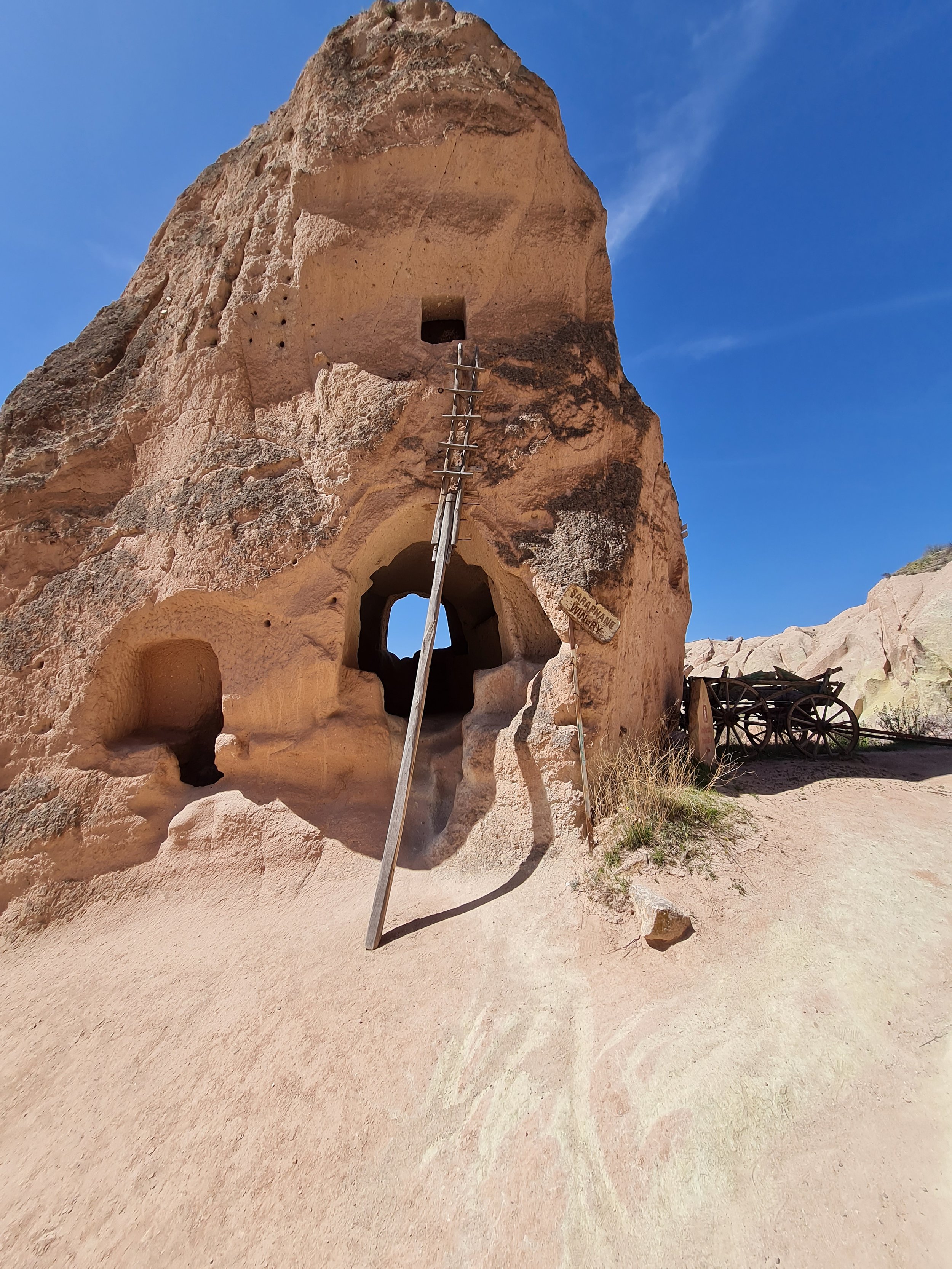
Cave home in Red Valley

Red Valley

Red Valley
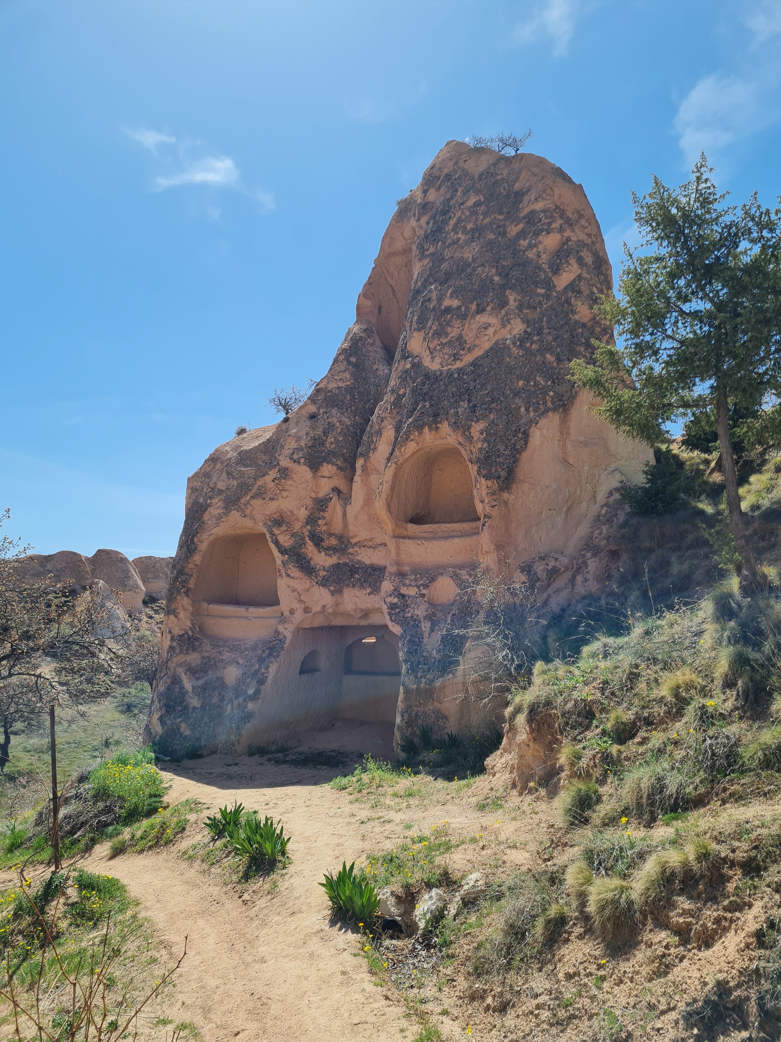
Cave homes in Red Valley
Ladder to climb out of Red Valley
After that ladder and these stone carved steps to pull yourself up and out of Red Valley

On the ridge overlooking Rose Valley
Rose Valley

Outside of Column Church
Outside of Column Church

Inside of Column Church

Inside of Column Church

Inside of Column Church

Inside of Column Church
Anna Johachim Church

Ancient bee house

Ancient bird house

Haçli Church and Star Box Cafe in the distance
Steps into Haçli Church
Fresco inside Haçli Church
View from Haçli Church
Star Box Cafe
Star Box Cafe

Trail descending into Sword Valley

Church in Sword Valley