

The North Coast 500
A breathtaking 516-mile loop around the north coast of Scotland, starting and ending at Inverness.
My original plan was to do the NC500 in a camper van, making use of the wild-camping opportunities that Scotland allows (wild camping is legal in Scotland). However, renting a camper van, coupled with the high cost of fuel, put that plan out of budget. So instead, I opted to borrow my mum's car and either camp or stay in hostels/B&Bs. That being said, I would highly recommend doing the NC500 with a campervan if your budget allows, as food and accommodation options are few and far between along the route. Also, the NC500 requires a lot of forethought and planning. You cannot just turn up in a town on the day and expect to find accommodation or even a table for dinner, as we soon learnt. So you will need to plan everything in advance and make reservations for food and board before starting your trip. Therefore, a campervan would allow you more flexibility in this sense.
We completed the 516 miles (ish) over 5 days. We were mostly interested in the nature sites, so didn't spend much time looking at castles or going to museums. And to keep costs down we didn't join in any tours apart from a whisky tour in Wick. This probably allowed us to get the route done in 5 days, but you could definitely spend much more time exploring the highlands and extend your trip.
Below, I've included our itinerary. We chose to travel clockwise, starting with some of the more epic scenery that I was looking forward to, and so ensuring we didn’t have to rush this section at the end. The roads in the west are more challenging to navigate, so if you are not the most confident driver, I would recommend taking an anti-clockwise route to get you more comfortable with the roads. The east coast has wider and more developed roads that slowly become more windy and single-track, and you move into the west.
My NC500 recommended route map
Day 1: Edinburgh to Applecross
Controversially, we did not start at the city of Inverness. Having arrived in through Edinburgh, we instead decided to drive straight to Loch Ness, cutting out the corner that would have taken us into Inverness, and drive from Loch Ness to Applecross. By taking this route, we actually missed out 61 miles of the official NC500 route.
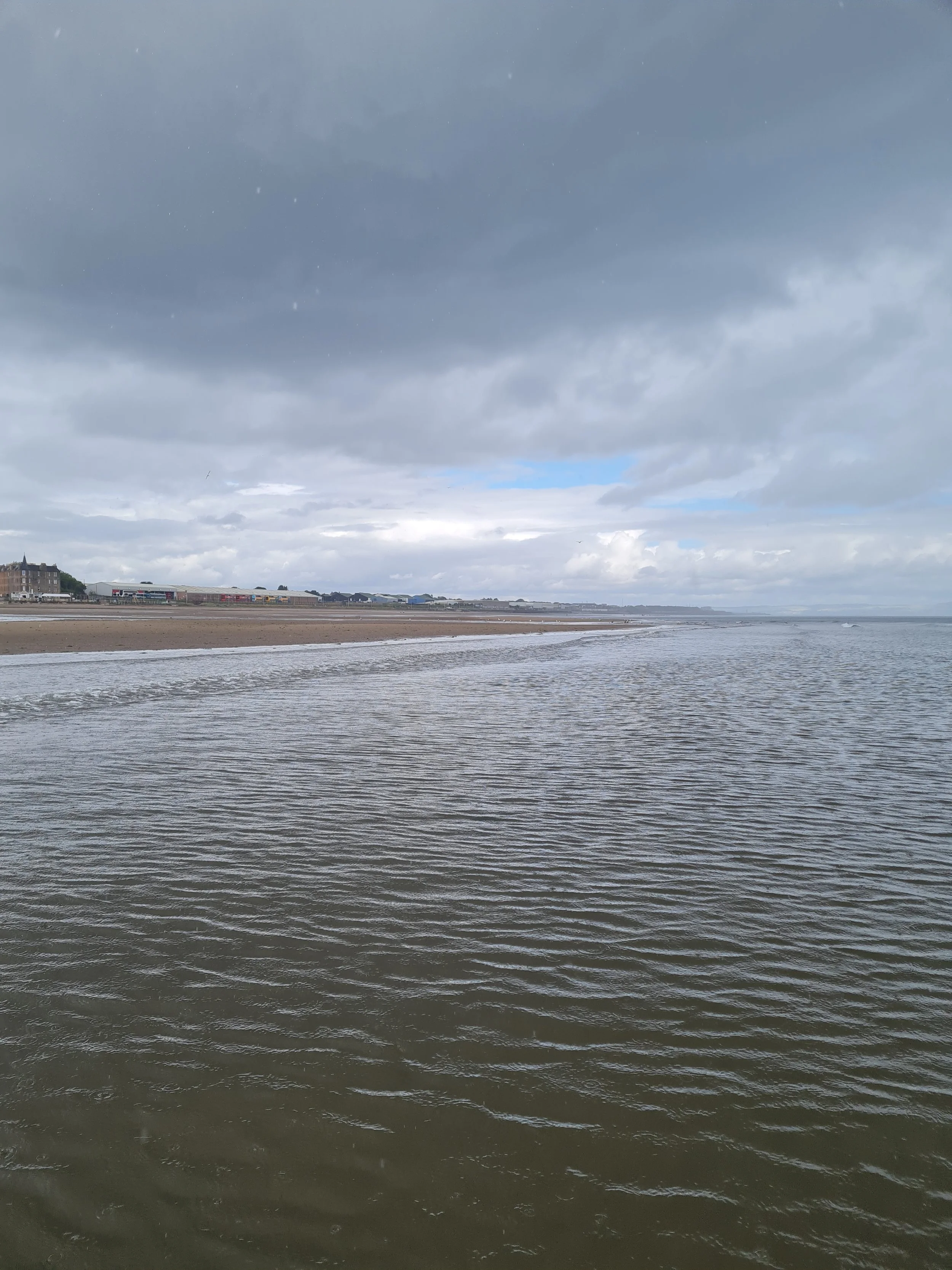
From Edinburgh, we drove to Fort Augustus, a little town situated on the west shore of Loch Ness. We arrived to find the town full of tourists, like us, stopping off to see the famous Loch Ness. I must say this was a bit anti-climatic. With the loch being so long, there wasn't much of a view other than the deep blue waters against the grey-blue sky. I think it would have been nicer to view the loch along one of the length way shores, where you could see the water juxtapose the highland landscape. Nevertheless, this little town was well-equipped with cafés, services, tour boats, and a small canal museum within the tourist centre. So a good stop to stretch your legs.
We then continued on to join the NC500 route at Strathcarron and drive the famous Bealach na Ba/Applecross Pass. This is a single track road that comes with a warning against large vehicles and inexperienced drivers. From our experience, this road was totally fine to drive in our car (which is the size of a small campervan). There were many passing places along the track that were well signposted and visiting at the end of summer season we only passed about 5 other driving vehicles. Unfortunately, the weather was not on our side and as we ascended higher up into the hills, the visibility severely reduced due to low-lying rain clouds.
We made it to our accommodation, Hartfield House Hostel - The Bunkhouse, but too late for any of the local shops to be open (6.30pm). There are few eating options here, being quite a small village, but we did manage to get ourselves a table at Applecross Walled Garden for dinner (reservations highly recommended, we had to sit outside in the rain). The food was delicious, and the gardens make for a beautiful backdrop.


Day 2: Applecross to Ullapool
We started our day with some fresh air and a walk down to the pink shore beach. The hostel is situated amongst farmland, so we saw plenty of highland cows, sheep, geese, and deer.
Our NC500 route today was going to hit some of the nature scenes that I was most excited about seeing, so we set off towards the village of Gairloch, making sure to hug the coast instead of following the sat-nav for the quickest route. The West Coast is majority made up of single-track roads which requires a cautious drive, but you are rewarded with absolutely stunning views of the landscape. We continued past Torridon, which is a popular stopping place, and arrived in Gairloch for a leg stretch and coffee break. We walked around their farm shop, tourist centre, cafés and pubs. Of note is Hillbillies Coffee that sells coffee grown from (Bob) Marley Farms and is attached to a bookstore specialising in adventure.
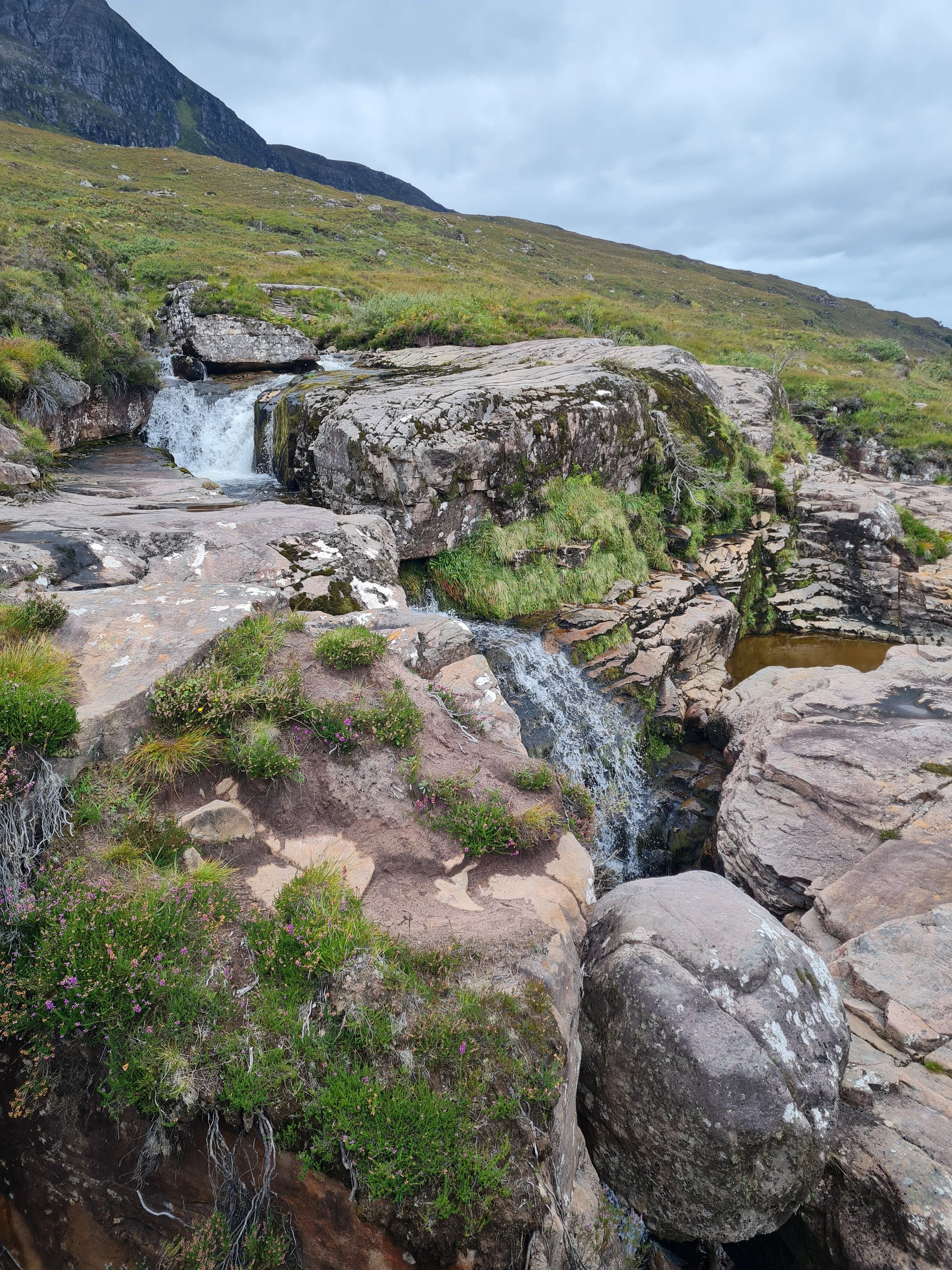
We continued our drive to Ardessie Falls, a waterfall that can be viewed from the road, but if you are able I highly recommend continuing on to hike it. There is a small car park nearby, situated in front of a Scottish Water building, and then a path that follows the road that leads you to the front of the falls. On the left of the falls, there is a sort of trail that takes you up the waterfall. It's not a clear marked path and has probably only been made by previous footfall. Be aware that it can be wet and boggy and that tall grass can mask dips in the ground. We hiked up to view three different waterfall levels, but it looks like it continues on and on. At one of these levels it was possible to sit in the pool below the waterfall, and to cross it (it was quite shallow, large and still). I would do this with caution, making sure not to underestimate the force of the water.
A short drive on from the falls, we arrived at Corrieshalloch Gorge Nature Reserve. It's signposted and has a designated carpark, a visitor centre is currently in development which I think will be a great addition. Previous pictures I had seen of this gorge did not do it justice. This gorge is huge! If you take the path on the right you will meander down to the gorge where there is a suspension bridge you can walk to cross it and see the gorge up close. If you continue over the bridge and follow the path, it will take you to a viewpoint a little further along where you can really understand the full scale of the gorge. Crossing back over the bridge and returning to the main path we chose to continue forward along the path to make it a loop. I will say that there isn't much more to view along this path and had I not wanted to stretch my legs more I would recommend turning back and going back the way you came. However, we continued on the loop, which wasn't very long, and it takes you to another viewpoint where there is more information about the gorge and how it formed. Then it's just an uphill walk, via steps and without rest benches, back to the car park.
From here we made our way to Ullapool where we were spending the night at an AirBnB. Again, limited options for dinner. The seafood food-truck we initially had our eye on had moved to off-season hours, so was shut by the time we arrived (7pm). We ended up eating some comfort food at a local pub/inn and getting an early night


Day 3: Ullapool to Loch Hope
Ullapool is a good NC500 town to stock up in. It has a big Tesco store, a petrol station and other services. Once we had bought some supplies and filled up our tank I was eager to leave straight away as for the first time on our trip we had blue skies and sun!
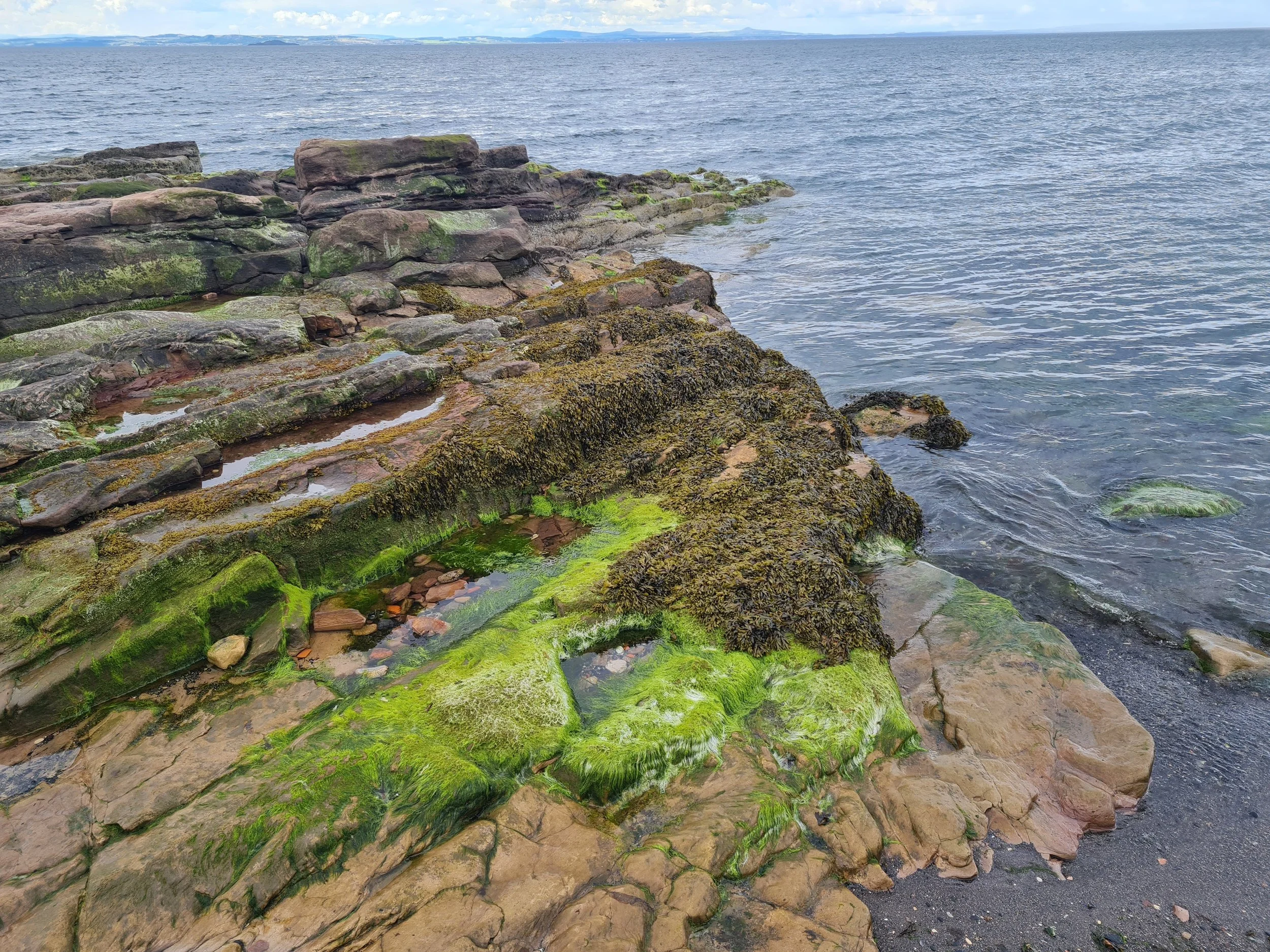
Our first stop was Achmelvich Bay, a stunning white sand and turquoise water beach. The road to get here is a slim single-track. Again, plenty of passing spaces well sign-posted, but there a couple blind turns here so make sure you take it slow. Well worth the drive, once we arrived we set up a picnic and stayed for an hour or so. Being in a bay we were sheltered from the wind and enjoyed the warmth of the sun. A couple people were swimming in the water, which I'm sure was very refreshing. There is a public toilet here, which was very well maintained and also a water tap.
After the beach, we continued along the single-lane track all the way up to Kylesku where it opens up to a nice two-way road. We crossed Kylesku Bridge and took a left immediately into the carpark to grab lunch from a seafood food truck Surf and Turf. The food was great, and they were serving the same dishes as some of the restaurants on the other side of the bridge at a fraction of the price.
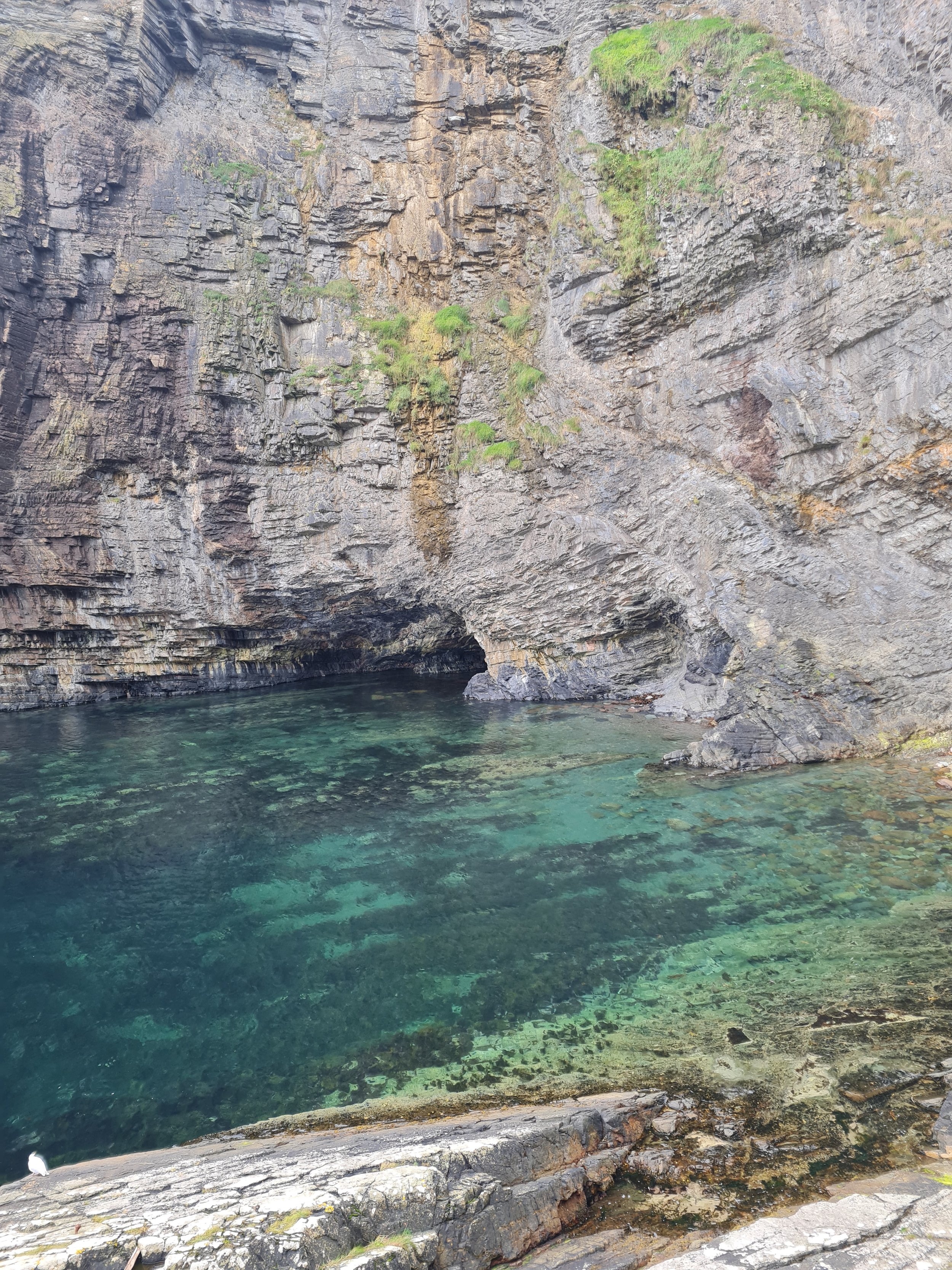
From here we drove up to Durness to view Smoo Cave. This was great. A huge cave with an opening at the top where you can see the sky, and a waterfall running into it. Like the gorge, this exceeded my expectations. On a good day (when it hasn't been too windy or rainy) it is possible to take a short boat tour into the cave to explore even deeper. After looking in the cave, and at the old winch left on the shore, we climbed above the cave to have a look at where the water runs in.
At this point evening was setting in, and since we had not been able to book accommodation in the surrounding area we had planned to camp tonight. I had a nearby bothy earmarked as an option, but had also noticed during our drives that areas near lochs could be quite flat and sheltered. We headed towards the nearest inland loch from Durness, Loch Hope and indeed close to the loch bed the land was flat and sheltered. We actually lucked out on finding a cleared area to park the car, due to nearby building works, and an old ruined building which we could use as shelter. We set up our tent within the building walls to provide extra wind break and watched the sun set over the hills. We had clear skies that night and were able to see a hint of the Milky Way.
In preparation for our night camping, we had stocked up on food from the Tesco in Ullapool. We had also packed with us a portable gas stove and a filled 5L water container. Of course, we had all the essentials; tent, sleeping mat, sleeping bag, torch etc. And we carried in everything we carried out (even used toilet roll!).


Day 4: Loch Hope to Wick
We had a fresh, sunny morning. And since we didn't have the comforts of a warm, comfy bed, we set off pretty early after packing up. There wasn't as much on the east coast of the NC500 that I was particularly excited about seeing, but we made it a must to visit the most northernly point on mainland Britain at Dunnet Head. It's quite a nice drive off the main road through long winding roads in the highlands. Upon reaching Dunnet Head there is a carpark and two short trails, one to the coastal edge, and another up a slight incline to get 360 views of Northern Scotland. Other than that, there were no other facilities and our visit was brief.
From here we drove back towards the town of Thurso, but opted to get food at the neighbouring harbour town Scrabster as we preferred the seafood options. We ate at The Upper Deck, the restaurant connected to The Ferry Inn, which offered loads of options for food. The server was really friendly, and I got to taste a delicious bowl of traditional cullen skink alongside our fresh mussels. I'd definelty recommend eating here, and we took our time seated by the large windows watching the boats come in and out.
Having slept 'wild' the night before we chose to check in to our B&B early and get a chance to shower and relax a little over the afternoon hours. We stayed at Horseshoecroft B&B and it was the best stay of our whole trip. Situated on the east coast between John O'Groats and Wick, the property is surrounded by farmland and sea air. Our room was warm and sunny with honestly such a comfortable bed and large ensuite bathroom. This felt like such a treat after our camping night. Around sunset we headed over to John O' Groats, often mistaken as the most northern point in Britain. It is a nice village to walk around with plenty of points of information to read up about the history of the area. From here we headed down to Wick for dinner at The Printer's Rest, one of the recommendations from our host. The Printer's Rest is an unlicensed restaurant so we brought our own bottle of wine and had a delicious spread of freshly baked bread, salads, dips and ribs. This was a very welcome change from the heavier meals we have been eating on the days before. We enjoyed dinner slowly, talking with other customers and the owners right till close.


Day 5: Wick to Inverness
Our final day on the NC500. Our B&B included a cooked breakfast of our choice alongside continental breakfast options. I was stuffed by check-out, which is just as well since we were going whisky tasting at noon. Before the whisky tour however we took a short detour to the Whaligoe Steps.
The steps are not signposted along the main road, so you will need your sat-nav for this. The single-track turn-off takes you down a short residential road with a small carpark at the end. Half of the bays are marked 'residents only' and the other half is available for visitors. There are no services available here, and a little information booklet to purchase should you want any information on the steps themselves. They've been well maintained by the locals and it is possible to walk the steps down to the cove as well as take the viewpoint path on your right before the steps themselves. I would recommend taking this trail, but I don't think you necessarily need to walk all the way to the 'viewpoint' as the views on the walk itself were better in my opinion. Beware, the trail is along the cliff edge so best for those who are sure-footed.
We booked to take a whisky tour with Pulteney Distillery based in Wick. I chose this option, one because it was still running tours on weekends which a couple distilleries had stopped doing since the end of the summer season, and two because it presented the best value for money. It involves a 1.5 hour tour of the distillery along with tasting of their whiskeys and a free whisky glass. Our tour guide was super knowledgable and made the tour surprisingly interesting for 1.5 hours of talking. We grabbed lunch in Wick back at The Printer's Rest, because once wasn't enough (!), and then started our drive to the Falls of Shin.
The Falls of Shin are famous for being one of the best places to see salmon leaping upstream on their way back to their birth place. I'd been told the best time to see salmon is around low-tide and we arrived 1 hour before low tide in nearby Tain. My expectations were low, but we were pleasently surprised. We saw about one salmon leaping every 2 minutes and it was so great to see. There is a visitor centre here which looked newly developed but it was closed when we arrived, hopefully just for the season. Outside of it however there were placards which provided more information about the salmon migration. This site also has an area for overnight parking should you be camping.
With the evening drawing in we drove the final leg of our NC500 route back into Inverness. We stayed at a local AirBnB walking distance to the town centre. Being a Saturday night, Inverness was buzzing and we enjoyed being back in a city by having a couple pints of local beers at the Black Isle Brewery.


Need to knows
Plan ahead: reserve restaurants and accommodation before your trip to avoid disappointment and relying on take-aways.
Special Recommendations
Achmelvich Bay
R’s take
As a woman I felt safe, the only concerns I had were about the remoteness of the area. There isn't much diversity up in the rural highlands, but since it's an area that is so used to tourism, everyone was very friendly and I felt comfortable travelling around.


Ardessie Falls

Ardessie Falls


Achmelvich Bay

Achmelvich Bay


Loch Hope

Loch Hope


Whaligoe
Whaligoe

Whaligoe
The North Coast 500 is a road route that loops around the Scottish Highlands, the very northern portion of mainland Great Britain. The NC500 starts and ends in Inverness. However, the route is a full loop, and therefore can be started and ended wherever you please.
Where is the NC500 and where does it start and end?
Whilst titled the North Coast 500, the NC500 is actually 516 miles in length. You can find the official route on the northcoast500 website.
How many miles is the NC500?
How many days do you need for the NC500?
At a bare minimum, I would recommend 5 days to complete the whole NC500 route. For this number of days you will likely spend an equal amount of time driving as you would exploring the different attractions. 7 - 10 days is probably the optimal time frame that would allow you enough time to really enjoy your surroundings and not get too stuck in the car. Of course you can take longer, and having flexibility in your travels is always nice. Alternatively, you don’t have to complete the full NC500 route, and instead pick and choose the locations that best suit you. By driving across the Highlands, instead of around, you can save some time.
The NC500 west coast has the most beautiful and astounding natural beauty. If you are looking for long windy paths, hidden lochs amongst the rolling hills, waterfalls, gorges, wildlife etc, then you will be satisfied. The N500 east coast has less impressive landscapes, but is richer in culture, history and heritage. Towns on this side are a little bigger and house museums, distilleries and award winning restaurants. There are also a couple castles that you can visit both as a grounds to walk around, or if you’re feeling fancy, as a hotel to spend the night. All along the NC500 are beautiful beaches and you’ll have plenty to choose from. Check out my map above with all my recommendations of things to see and do.
What is there to see and do along the NC500?
I would strongly suggest taking a good pair of walking shoes, preferably waterproof, as the terrain can be uneven and boggy, even when it hasn’t rained in a while. A windproof is a must - it didn’t matter how sunny it was, no hoody could do what a windproof can. Finally, I would definitely recommend a pair of long trousers for walking, or at the very least a tick remover. If you plan on hiking at all, then you will be at risk of tick bites as the land here is often left natural. Other than that, check the weather and pack accordingly. I personally think it’s best to be prepared for all weather conditions, as being near the coast, weather can change quite quickly - so waterproofs, sun protection, warm clothes etc.